![]()
We highly recommend using Highway 58 unless you live in Seymour.
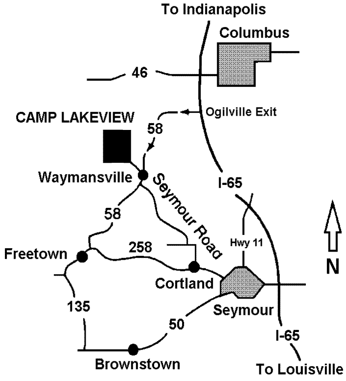
If you are coming from Indianapolis, Evansville, Louisville, Cincinnati, or Columbus, use major highways to get to I-65. From I-65, take the Ogilville exit (#64). Go WEST on Highway 58 for 8 miles. At Waymansville, turn sharp right at the general store onto 930 S. (also called “Lake Rd.”). Go 1.5 miles on Lake Rd. The camp entrance will be on the right.
If you are coming from Seymour and are not near I-65 already, take 6th Street west. This becomes Highway 258 as it leaves town. Go WEST for 3 miles, then turn right at the blinking light in Cortland onto 400 E. Go 2.3 miles, then turn left onto 875 N. Go a quarter mile, then turn right onto 375 E. This road will turn into Waymansville Pike and, eventually, Seymour Road as it weaves its way north and west for 6.1 miles. It ends at Highway 58. Turn right onto Highway 58 and travel a quarter mile until you reach the Waymansville General Store. Turn left at the general store onto 930 S. (also called “Lake Rd.”). Go 1.5 miles on Lake Rd. The camp entrance will be on the right.
If you are coming from Brownstown, Bedford, or Nashville, there are shorter routes (besides going to Seymour or I-65) through the country. Please do not attempt these alternate routes without a GPS system or internet directions.
Directions to Lakeview Villages are the same, except after going 1.5 miles on Lake Rd., the entrance to Lakeview Villages will be on the left (directly across the road from the Camp Lakeview entrance).
Camp Lakeview is close to many major cities
Look at the map below for approximate mileage from those cities.
2 miles west of Waymansville
15 Miles Southwest of Columbus
15 Miles Northwest of Seymour
55 Miles South of Indianapolis
70 Miles North of Louisville
110 Miles West of Cincinnati
155 Miles Northeast of Evansville
Only 10 Miles from the I-65 & Highway 58 Junction

